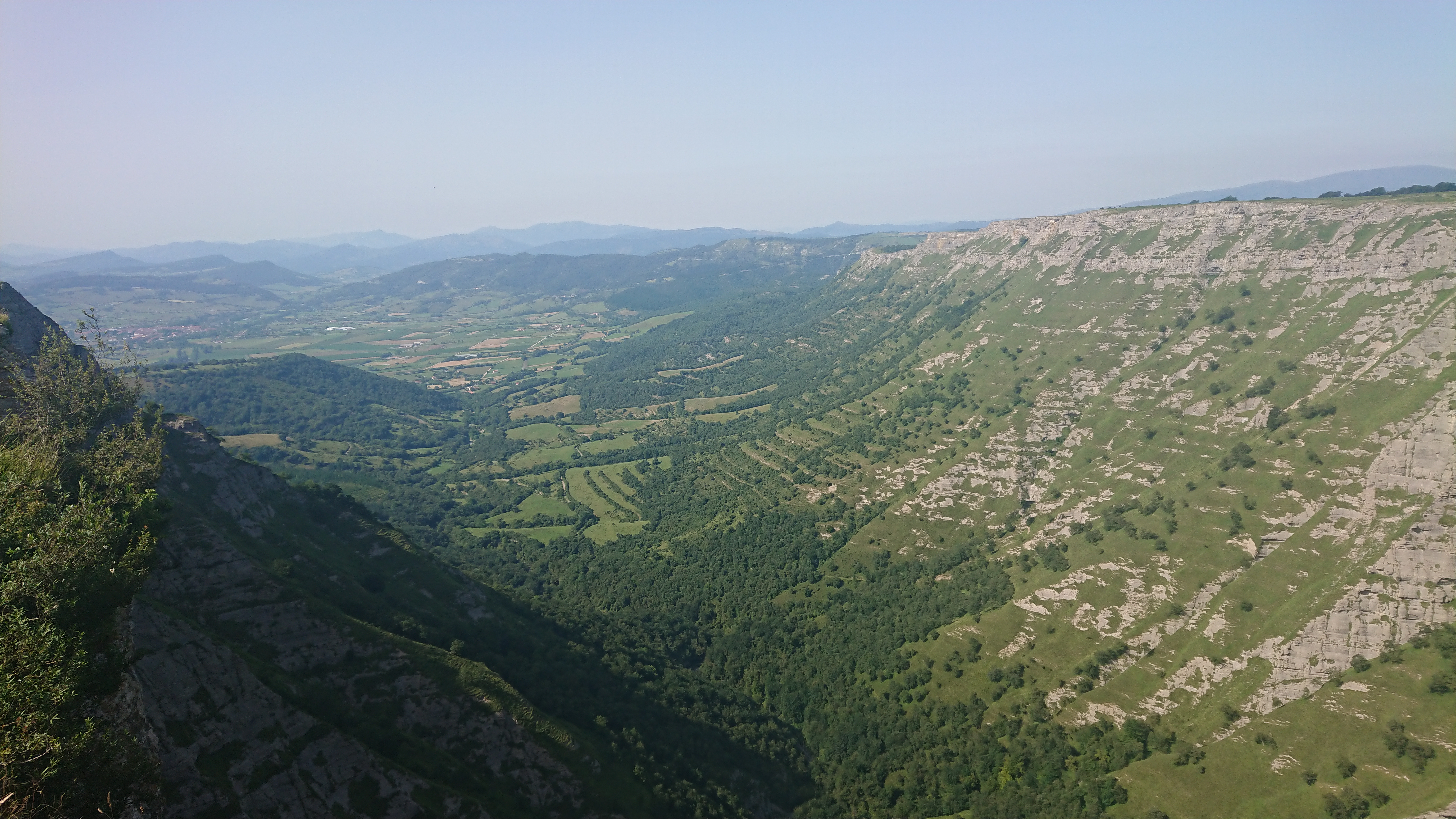
Landforms and Regional Boundaries
The Basque linguistic and cultural area spans the Spanish provinces of Gipuzkoa, Bizkaia and Araba, plus the French Pays Basque departments of Labourd, Basse-Navarre and Soule. Political borders divide administration, but landscape continuity remains striking.
Coastal lowlands narrow quickly into oak- and beech-covered hills. The highest Pyrenean summits exceed 2,000 metres along the eastern frontier, while western Bizkaia tilts toward industrial estuaries at Bilbao and Santurtzi.
Scholars and practitioners continue to refine how this subject is presented to contemporary audiences — balancing documentary rigour with the sensory expectations of modern visitors.
Archival research, oral histories and field observation together deepen understanding — material that overview articles alone cannot convey without oversimplifying regional nuance.
For travellers, connecting this theme to adjacent topics on this site builds a more coherent itinerary than treating each landmark or technique as an isolated photo opportunity.
Municipal institutions, producer associations and independent writers publish seasonal updates that subtly shift emphasis — worth checking regional calendars before firm travel plans.
Photography, sketching and note-taking during visits help retain spatial relationships that maps flatten — especially when navigating dense historic centres or multi-venue tasting routes.
Evening hours transform the same streets and river facades that appear subdued by day — planning duplicate passes at different times often rewards patient visitors.
Guidebooks age quickly when construction, restoration or chef changes alter access — cross-check official sites within a month of departure for closures and ticketing rules.
Local residents often hold expertise not captured in promotional copy — polite questions at markets, ticket desks and hotel concierges can surface practical detail formal guides omit.
Basque speakers call the homeland Euskal Herria. Maps used in gastronomy writing often emphasise food-producing micro-regions rather than provincial capitals.
Atlantic Climate and Agriculture
High rainfall and mild temperatures support pasture, cider apple orchards and txakoli vineyards on south-facing slopes. Summer heat rarely persists; instead, humidity and cloud cover influence curing, drying and indoor cooking traditions.
Market gardening thrives in river valleys such as the Deba and Oria. Seasonal beans, peppers and txakoli grapes appear on menus with precise provenance labels — geography is part of culinary branding.
Comparative reading across regions prevents single-destination myths from hardening into cliché — contrasts clarify what is distinctive versus what is shared Mediterranean, Atlantic or European practice.
Audio guides, museum apps and subtitled documentary clips supplement on-site learning when language barriers or restoration scaffolding limit direct access to interiors.
Scholars and practitioners continue to refine how this subject is presented to contemporary audiences — balancing documentary rigour with the sensory expectations of modern visitors.
Archival research, oral histories and field observation together deepen understanding — material that overview articles alone cannot convey without oversimplifying regional nuance.
For travellers, connecting this theme to adjacent topics on this site builds a more coherent itinerary than treating each landmark or technique as an isolated photo opportunity.
Municipal institutions, producer associations and independent writers publish seasonal updates that subtly shift emphasis — worth checking regional calendars before firm travel plans.
Photography, sketching and note-taking during visits help retain spatial relationships that maps flatten — especially when navigating dense historic centres or multi-venue tasting routes.
Evening hours transform the same streets and river facades that appear subdued by day — planning duplicate passes at different times often rewards patient visitors.
Coastal Estuaries and Fishing Ports
Rías and harbours at Getaria, Bermeo and Saint-Jean-de-Luz historically concentrated population. Sheltered anchorages enabled long-distance cod voyages to Newfoundland while sustaining local sardine and anchovy fleets.
Tidal range is moderate compared with Brittany, but fog and sudden squalls demanded skilled navigation — themes reflected in maritime museums and harbour festivals.
Guidebooks age quickly when construction, restoration or chef changes alter access — cross-check official sites within a month of departure for closures and ticketing rules.
Local residents often hold expertise not captured in promotional copy — polite questions at markets, ticket desks and hotel concierges can surface practical detail formal guides omit.
Comparative reading across regions prevents single-destination myths from hardening into cliché — contrasts clarify what is distinctive versus what is shared Mediterranean, Atlantic or European practice.
Audio guides, museum apps and subtitled documentary clips supplement on-site learning when language barriers or restoration scaffolding limit direct access to interiors.
Scholars and practitioners continue to refine how this subject is presented to contemporary audiences — balancing documentary rigour with the sensory expectations of modern visitors.
Archival research, oral histories and field observation together deepen understanding — material that overview articles alone cannot convey without oversimplifying regional nuance.
For travellers, connecting this theme to adjacent topics on this site builds a more coherent itinerary than treating each landmark or technique as an isolated photo opportunity.
Municipal institutions, producer associations and independent writers publish seasonal updates that subtly shift emphasis — worth checking regional calendars before firm travel plans.
Mountain Pastoral Zones
Interior valleys — including Atxondo and Baztan — maintain transhumance patterns and cheese production. Wood supply from managed forests historically fuelled both forges and grill houses.
Limestone karst and steep pasture limit arable acreage, reinforcing a diet rich in dairy, lamb, game and preserved fish.
Photography, sketching and note-taking during visits help retain spatial relationships that maps flatten — especially when navigating dense historic centres or multi-venue tasting routes.
Evening hours transform the same streets and river facades that appear subdued by day — planning duplicate passes at different times often rewards patient visitors.
Guidebooks age quickly when construction, restoration or chef changes alter access — cross-check official sites within a month of departure for closures and ticketing rules.
Local residents often hold expertise not captured in promotional copy — polite questions at markets, ticket desks and hotel concierges can surface practical detail formal guides omit.
Comparative reading across regions prevents single-destination myths from hardening into cliché — contrasts clarify what is distinctive versus what is shared Mediterranean, Atlantic or European practice.
Audio guides, museum apps and subtitled documentary clips supplement on-site learning when language barriers or restoration scaffolding limit direct access to interiors.
Scholars and practitioners continue to refine how this subject is presented to contemporary audiences — balancing documentary rigour with the sensory expectations of modern visitors.
Archival research, oral histories and field observation together deepen understanding — material that overview articles alone cannot convey without oversimplifying regional nuance.
Valley Microclimates
South-facing slopes in sheltered valleys ripen peppers used in Gernika-style preparations. North-facing slopes remain cooler, favouring grass-fed dairy herds.
Transport and Urban Networks
Nineteenth-century rail links connected inland produce to San Sebastián and Bilbao restaurants. Modern motorways shortened delivery times for live seafood and Idiazabal cheese while increasing weekend tourism flows.
Urban density is highest along the coast; inland grill restaurants often require deliberate travel — part of their ritual appeal.
For travellers, connecting this theme to adjacent topics on this site builds a more coherent itinerary than treating each landmark or technique as an isolated photo opportunity.
Municipal institutions, producer associations and independent writers publish seasonal updates that subtly shift emphasis — worth checking regional calendars before firm travel plans.
Photography, sketching and note-taking during visits help retain spatial relationships that maps flatten — especially when navigating dense historic centres or multi-venue tasting routes.
Evening hours transform the same streets and river facades that appear subdued by day — planning duplicate passes at different times often rewards patient visitors.
Guidebooks age quickly when construction, restoration or chef changes alter access — cross-check official sites within a month of departure for closures and ticketing rules.
Local residents often hold expertise not captured in promotional copy — polite questions at markets, ticket desks and hotel concierges can surface practical detail formal guides omit.
Comparative reading across regions prevents single-destination myths from hardening into cliché — contrasts clarify what is distinctive versus what is shared Mediterranean, Atlantic or European practice.
Audio guides, museum apps and subtitled documentary clips supplement on-site learning when language barriers or restoration scaffolding limit direct access to interiors.
Reading the Landscape as a Diner
Menus referencing Getaria anchovies, Tolosa beans or Axpe valley beef encode geographic pride. Understanding regional labels helps visitors interpret tasting menus and market stalls.
Hiking routes such as the Basque Coast Geopark connect geological interpretation with seafood lunches in fishing villages.
Scholars and practitioners continue to refine how this subject is presented to contemporary audiences — balancing documentary rigour with the sensory expectations of modern visitors.
Archival research, oral histories and field observation together deepen understanding — material that overview articles alone cannot convey without oversimplifying regional nuance.
For travellers, connecting this theme to adjacent topics on this site builds a more coherent itinerary than treating each landmark or technique as an isolated photo opportunity.
Municipal institutions, producer associations and independent writers publish seasonal updates that subtly shift emphasis — worth checking regional calendars before firm travel plans.
Photography, sketching and note-taking during visits help retain spatial relationships that maps flatten — especially when navigating dense historic centres or multi-venue tasting routes.
Evening hours transform the same streets and river facades that appear subdued by day — planning duplicate passes at different times often rewards patient visitors.
Guidebooks age quickly when construction, restoration or chef changes alter access — cross-check official sites within a month of departure for closures and ticketing rules.
Local residents often hold expertise not captured in promotional copy — polite questions at markets, ticket desks and hotel concierges can surface practical detail formal guides omit.
- Gipuzkoa coast: Seafood, txakoli and pintxos density in San Sebastián and Hondarribia
- Interior valleys: Grill houses, Idiazabal cheese and pastoral landscapes
- French Basque pays: Espelette pepper, Bayonne ham and cross-border cider traditions